Last updated: 21 September 2016, 18:08 (all times in UTC+2)
map I can think of a number of very unappealing border towns, but Mittenwald is a pleasant exception. Some of that is surely due to the scenery between the Wettersteingebirge and the Karwendel, but the Bavarian appreciation for a consistent appearance of townscapes must have something to do with it as well. Nearby, otherwise similar towns on the other side of the border probably used to be lovely little places too, but opened up to modern mass tourism without regard for appropriate architecture. As Innsbruck’s closest neighbour in Germany, Mittenwald and the capital of Tirol are well-connected. In addition to a major road, called B 2 in Germany and B177 Seefelder Straße in Austria, there is the Mittenwaldbahn: This railway line, built between 1910 and 1912, has been run on electrical power from the very beginning and is arguably one of Austria’s most beautiful. I will take a different route, one far from busy roadways and rails.
The main street through the town centre of Mittenwald.

map David has to work today and took one of those trains to go to the office early in the morning. Since the other two people who had planned to be with me today also couldn’t make it, I am on my own for the first time on this journey as I make my way from Mittenwald to Scharnitz on the other side of the German–Austrian border. I intended to meet two people there, but my phone just received a message from one of them: He woke up sick today. map Once more, the best way to get from here to there is via the Isar. At this point, the river is just about 25 kilometres old and I will even follow it some way into the Hinterautal, the valley where it rises.
Following the Isar between Mittenwald and the border to Austria.

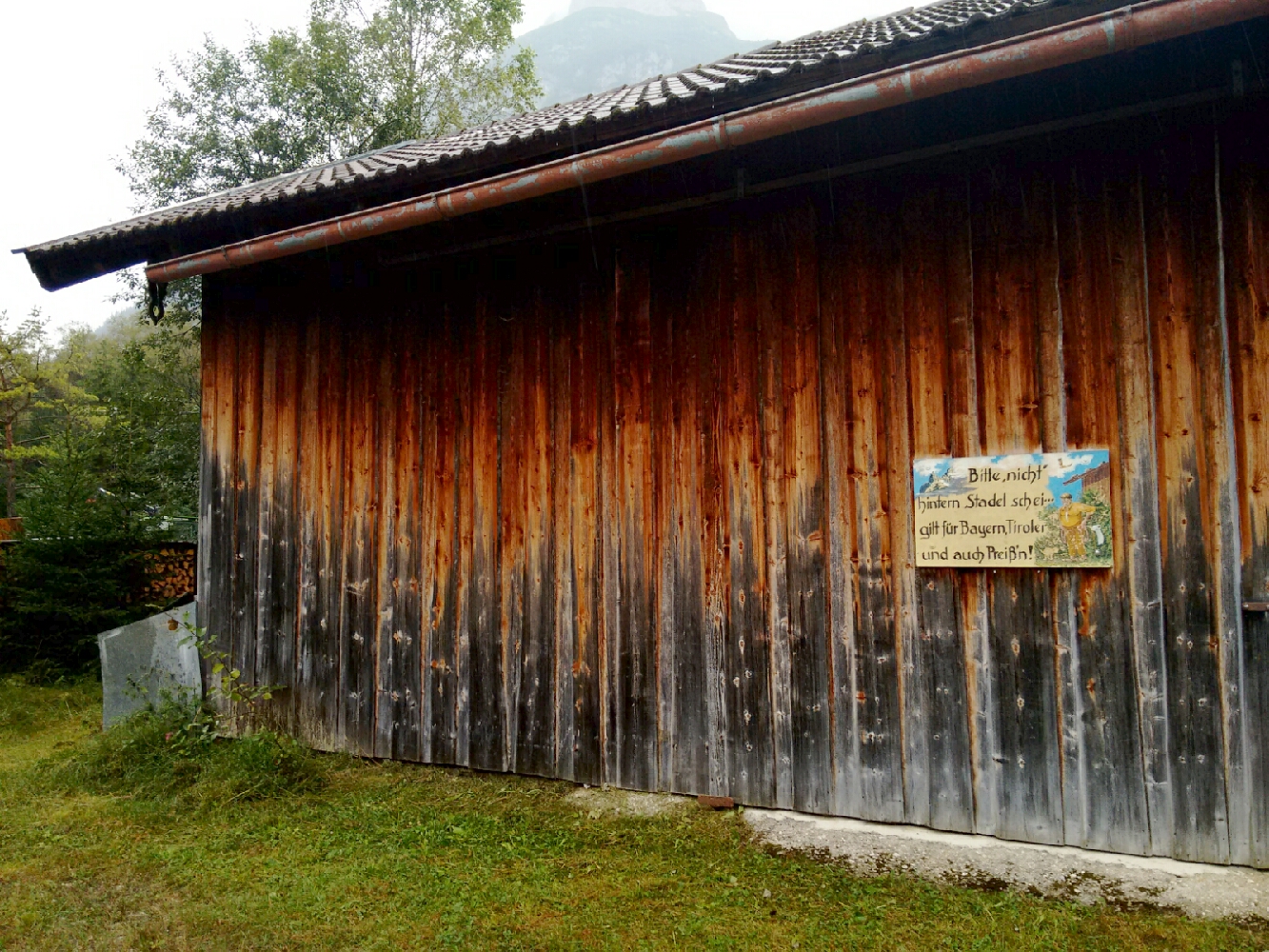
This sign says “Please don’t sh— behind the barn. That goes for Bavarians, Tyroleans, and Prussians too”. Conveniently, the vulgar synonym for “to defecate” rhymes with the most popular Bavarian derogative for non-Bavarian Germans.
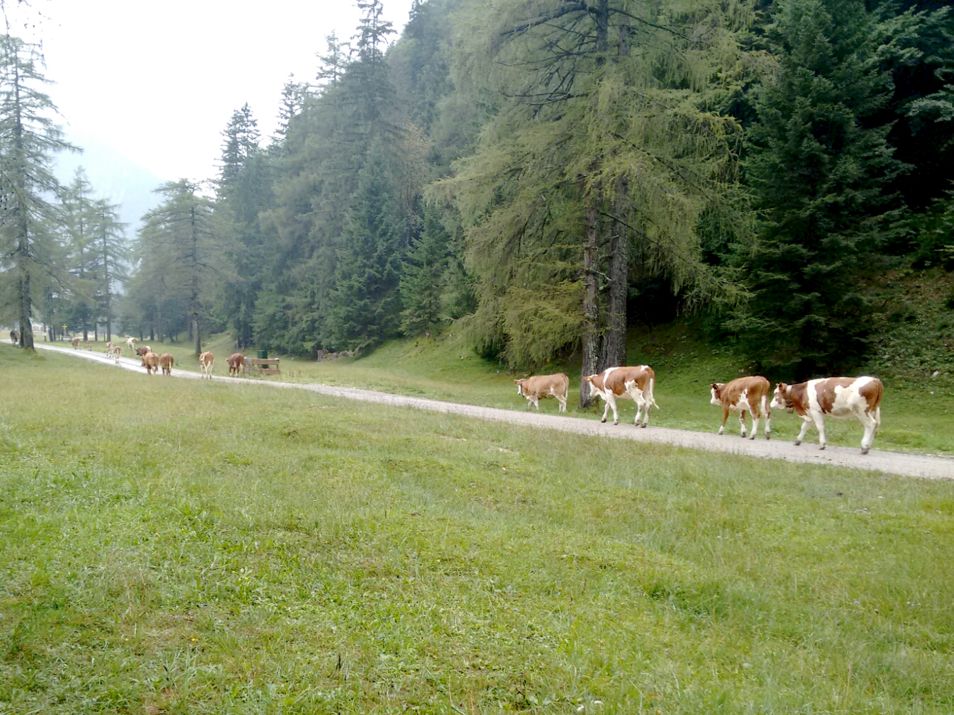
I walk with a herd of cattle across a pasture next to the Isar.
map To leave Germany for Austria is a story of loss: The postcodes lose a digit, the population number loses an order of magnitude, and people lose their strict adherence to rules (and thus the ability to hold proper nationwide elections). But of course, these aren’t things you would notice at the moment you cross the border: In 1997, regular roadside border posts were replaced with little signs that say “Republik Österreich” going south or “Bundesrepublik Deutschland” going north; when you cross at a hiking path, there is no official evidence whatsoever of any kind of international border.
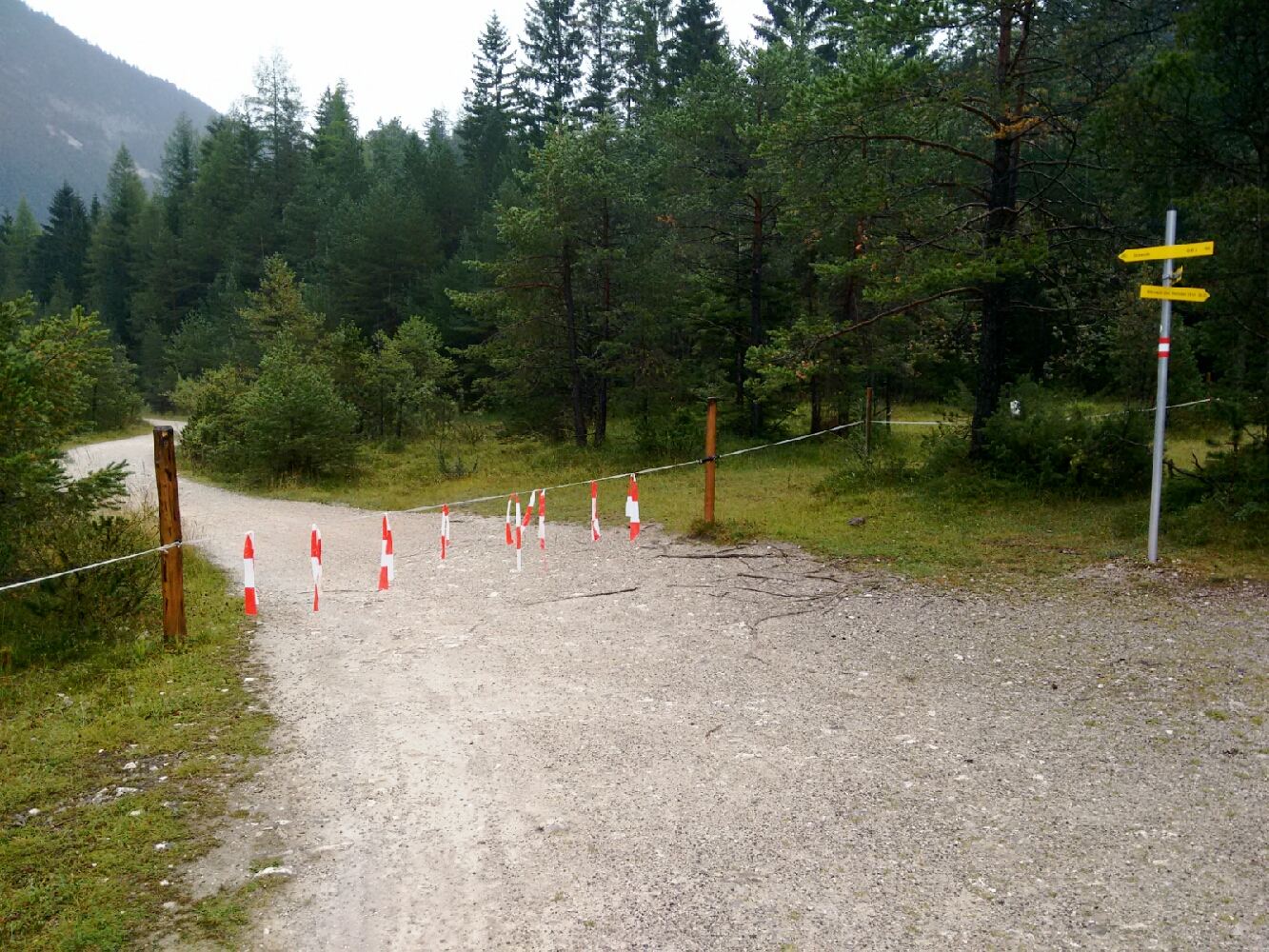
The primary purpose of this removable piece of electric fence is to let humans pass, but keep cows inside. Someone used the fact that red-white warning tape looks like the flag of Austria to unofficially mark the border.
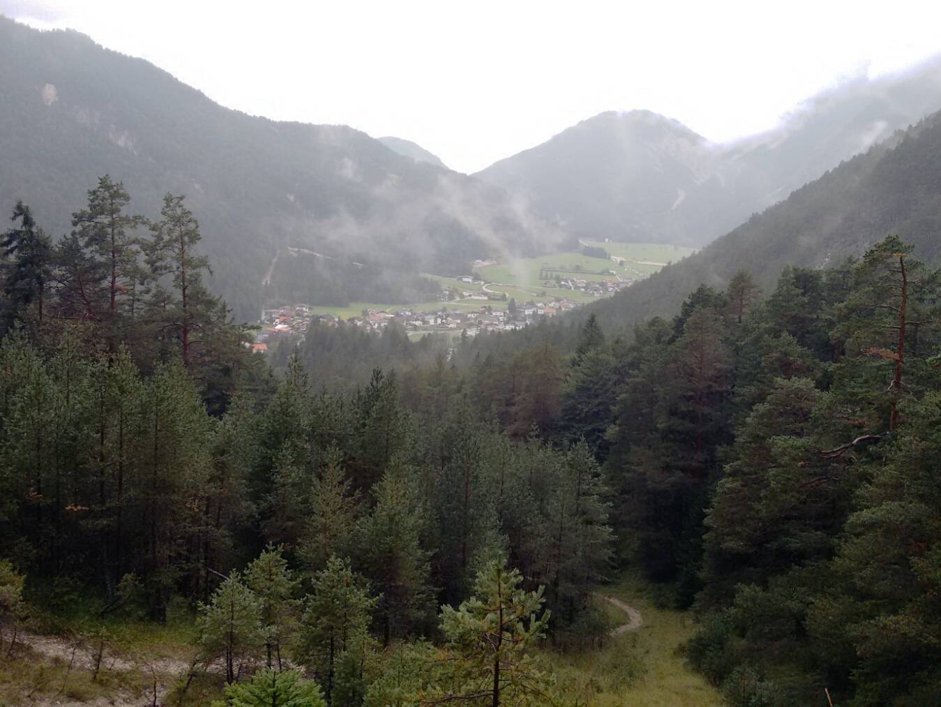
map In Scharnitz, I have to deviate from my intended route because the hiking path along the river had to make way for a construction site related to a road bypass project. map There is no sensible way around the B177, so I follow it to the train station to pick up Martin, a friend from highschool who will walk from here to Innsbruck with me. map Despite the rain, I let him persuade me to not directly follow the Isar into Hinterautal, but to climb to a small chapel above the valley from where we can get a good view.
The view from the Birzlkapelle above Scharnitz.
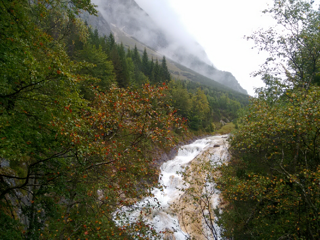
map With an impressive rugged mountain face on our left, the path goes on to the Karwendelsteg, a bridge over the Karwendeltal valley which gave this mountain range its name. map We look down on the river of the valley, the Karwendelbach, which features a waterfall here.
The Karwendelbach seen from the Karwendelsteg.
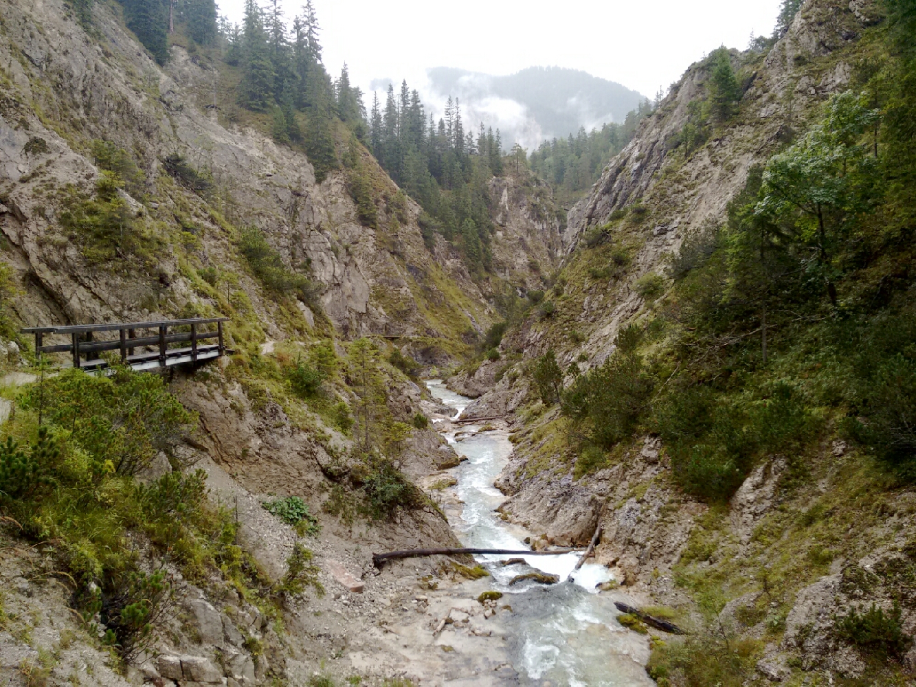
map We quickly lose altitude again and end up on a bridge over the Isar near Wiesenhof, an inn which marks the end of the road that is accessible to public motorised traffic. map Almost two kilometres upstream we have to options: To proceed on a wide forest road designed to let logging and service vehicles access the area, or to walk through a spectacular ravine. This was not a difficult decision.
Gleirschklamm, a narrow gorge in the Karwendel mountains near Scharnitz.
map After the ravine, though, the forest road turns into the only possible path. We find a bench here and have a late lunch break. map With most of today’s climb behind us, this section of our route is mostly flat. We follow the same stream that passed through the gorge, called Gleirschbach, for a good while. map As Austria does not have unincorporated areas, every piece of land belongs to a municipality. And so the inevitable happens just as we cross Gleirschbach over a small bridge: We are no longer in Scharnitz; we’re now in Innsbruck. map The first buildings we see are on the other side of the stream and thus just outside the city boundary. The Amtsäge is known to have existed at least since 1600 and used to be an important supplier of the salt mines above Hall in Tirol, via a road over the Stempeljoch and into the Halltal. Until a few years ago, food was served here. Now the buildings appear to be unused.
Amtsäge, a former sawmill and mountain restaurant.

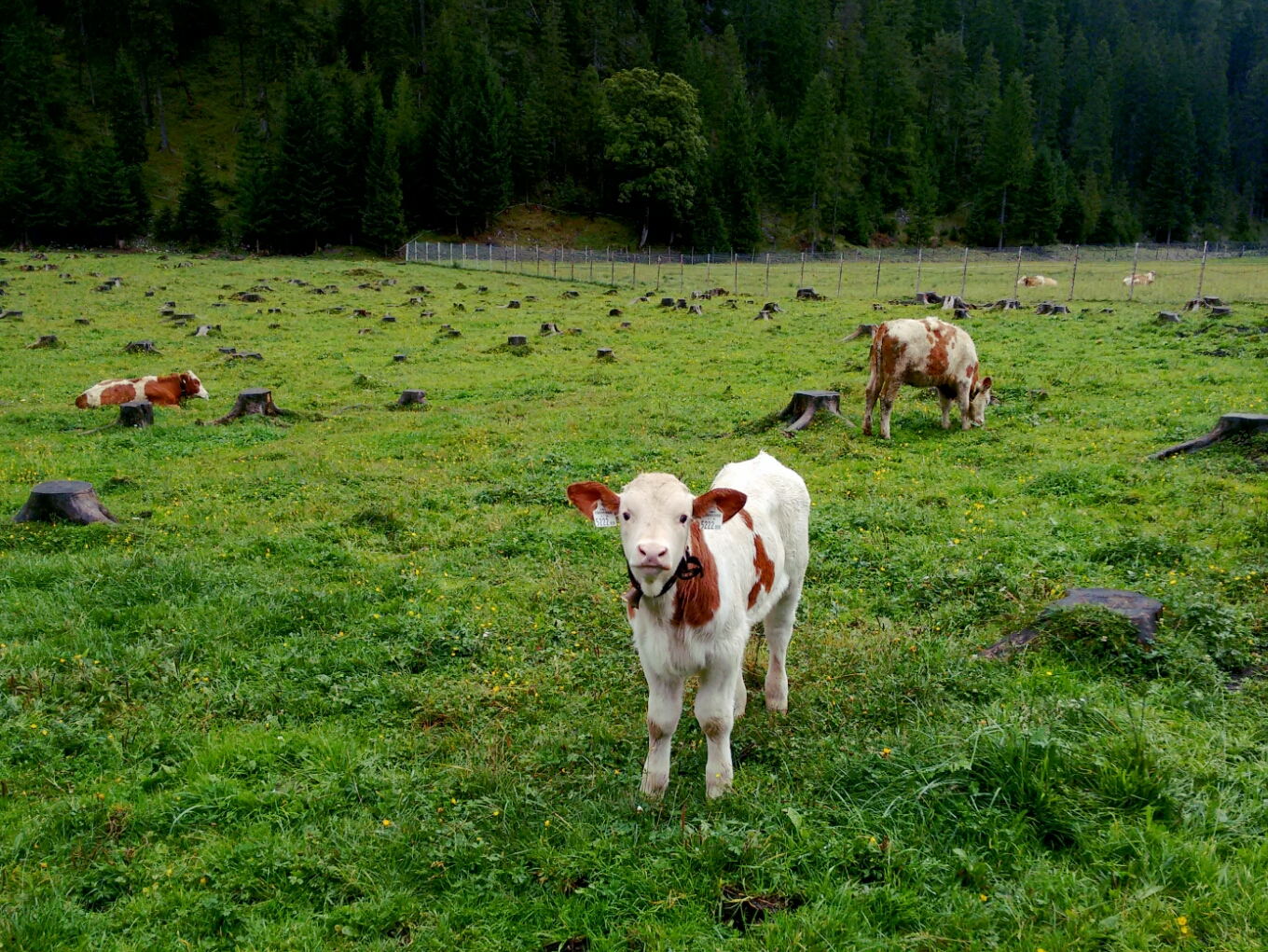
map Upon arrival at Möslalm, the summer mountain pasture (Alm) which will serve us with food and a bed until tomorrow, the landlady confirms our location: As I naïvely mention to her that Martin and I will complete our journey to Innsbruck tomorrow, she jokingly tells me “da bisch a schu”, “but you’re already there!” Considering this, we’re remarkably far from civilisation: This is the first time on the trip that I’ve been without mobile phone reception. And that’s despite the just 14 kilometres which separate me from my house in the capital of Tirol.
A cute calf greets us at Möslalm, the last overnight stop before Innsbruck.
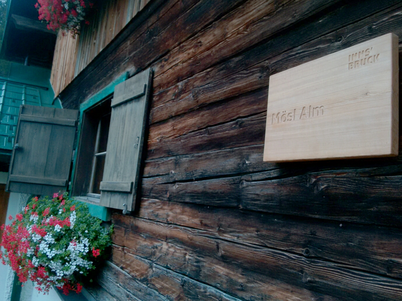
The Alm is not just administratively located in Innsbruck, but indeed owned by the city government, as a wooden sign on the chalet reveals.
Last updated: 21 September 2016, 18:08
I can see my house from here